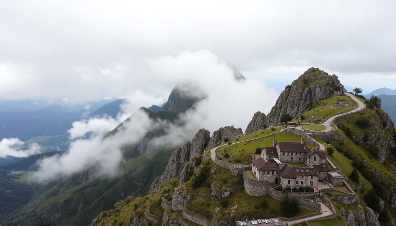
Set your eyes on the horizon from Newcastle’s beach on a clear day and you’ll spot it: the broad granite shoulder of Slieve Donard, Northern Ireland’s highest mountain — confirmed by the region’s official tourism body, Visit Mourne, at 852 metres with a 2.9-mile climb from Donard Park and a four-star hotel at its base. The mountain’s name also hangs over a 22-mile wall built to safeguard Belfast’s water supply — this guide connects the hike, the history, and the stay.
Height: 852 m (2,795 ft) ·
Location: Mourne Mountains, County Down, Northern Ireland ·
Hike Distance: 9.2 km round trip (4.6 km one way) ·
Hike Duration: 4–5 hours ·
Difficulty: Moderate ·
Nearest Town: Newcastle
Quick snapshot
- Slieve Donard is the highest mountain in the Mournes (Visit Mourne)
- The standard route starts at Donard Park in Newcastle (Visit Mourne Gullion Strangford)
- The Mourne Wall was built between 1904 and 1922 (Visit Mourne)
- The final ascent follows the wall to the summit (Visit Mourne)
- Exactly which Game of Thrones scenes were shot on Slieve Donard itself versus nearby Tollymore Forest and Murlough Bay — no complete official map was published
- How long you’ll need: the official estimate is 4–5 hours, but a leisurely pace can stretch toward six
- Whether Slieve Donard Hotel’s pricing matches its value — guest reviews are mixed on that point
- The exact date of the hotel’s refurbishment isn’t confirmed in the official tourism sources cited here
- 1904–1922: the Mourne Wall is built to protect the Silent Valley catchment (Visit Mourne)
- 1920s: Silent Valley Reservoir is completed; the wall becomes a working water barrier (regional water authority history)
- Early 2000s: Slieve Donard Hotel is refurbished (hotel marketing)
- 2011–2019: Game of Thrones brings Mourne landscapes to a global audience (screen-tourism coverage)
- Park at Donard Park and follow the Glen River path toward the saddle (Visit Mourne)
- Join the Mourne Wall at the saddle for the final push to the summit (Visit Mourne)
- Book the Slieve Donard Hotel before summer weekends — it sits directly at the foot of the trail
- Check mountain weather before you set out; mist can cut visibility quickly (Visit Mourne)
Eleven facts, one pattern: every figure points to the same plan — start at Donard Park, follow the river, join the wall, summit in 4–5 hours.
| Height | 852 m (2,795 ft) (Visit Mourne) |
| Location | Mourne Mountains, County Down, Northern Ireland |
| Pronunciation | “Sleeve Donard” — from Irish Sliabh Donnairt |
| Rank in the Mournes | Highest; Northern Ireland’s highest mountain (Visit Mourne) |
| Standard hike distance | About 2.9 miles (4.6 km) one way (Visit Mourne) |
| Round trip | 9.2 km by the same route |
| Time needed | 4–5 hours return (Visit Mourne) |
| Difficulty | Moderate — clear and non-technical, but relentless (Visit Mourne) |
| Start point | Donard Park, Newcastle (Visit Mourne) |
| Route type | Linear, not circular (Visit Mourne Gullion Strangford) |
| Mourne Wall | 22 miles (35 km) of granite, crossing 15 summits (Visit Mourne) |
How do you pronounce Slieve Donard?
Correct pronunciation of Slieve Donard
- Say it like “Sleeve Don-ard” — “Sleeve” rhymes with “leave”.
- The name comes from the Irish Sliabh Donnairt, meaning “Donnairt’s mountain”.
- Stress falls on the first syllable of Donard: DON-ard, not don-ARD.
That is the standard anglicised form, and the one you’ll hear in Newcastle pubs and on the mountain itself. The Irish original carries a personal name rather than a description, which is why the mountain sounds more like a person than a landscape feature.
Common mispronunciations
- “Sly-ve” — the first syllable rhymes with “sleeve”, not “sly”.
- “Don-ARD” with the stress on the second syllable — it is DON-ard, like Donald with an r.
- “Slieve Donald” — the final d is often swallowed; keep it crisp.
The good news: mispronouncing the name is the most harmless mistake you can make here. Everyone in the Mourne tourism business has heard every version, and “Sleeve Donard” will get you pointed in the right direction — literally, up.
The pattern: this is a name more often read than said aloud, so the gap between spelling and sound causes the confusion. Say it once, and the image of the mountain locks the sound in place.
What are the 7 tallest peaks in the Mournes?
List of the seven highest mountains in the Mournes
- The top seven all rise above 680 metres.
- They sit in the eastern Mournes, close to Newcastle — where the official route to the range’s highest summit begins (Visit Mourne).
Seven summits, one pattern: the big numbers cluster together, most of them visible from the Slieve Donard summit itself.
| Rank | Peak | Height |
|---|---|---|
| 1 | Slieve Donard | 852 m |
| 2 | Slieve Commedagh | 767 m |
| 3 | Slieve Binnian | 747 m |
| 4 | Slieve Bearnagh | 739 m |
| 5 | Slieve Lamagan | 703 m |
| 6 | Slieve Meelmore | 687 m |
| 7 | Slieve Meelbeg | 686 m |
Slieve Donard: the highest
- The highest of the Mourne Mountains and of Northern Ireland (Visit Mourne)
- Forms the opening climb of the Mourne Wall Challenge, which crosses 15 summits (Visit Mourne)
- The last stretch of the standard ascent follows the Mourne Wall to the summit (Visit Mourne)
Because Donard is the first summit you meet on the Wall Challenge, it sees more traffic than any other peak in the range. On a fine summer weekend, the path from the saddle can feel like a procession. Go early, and you’ll have the wall’s granite blocks and the sea below to yourself for a while.
For first-time visitors, the eastern Mournes concentrate the whole story of the range: you summit Donard, follow the wall, and pick out the next three highest peaks from one vantage point.
What this means: if you only have one day in the Mournes, Slieve Donard gives you the highest peak, the historic wall, and a view that makes the rest of the list click into place.
Why is there a wall in the Mourne Mountains?
History of the Mourne Wall
- Approximately 22 miles (35 km) of dry-stone wall, crossing 15 summits (Visit Mourne)
- Built between 1904 and 1922 — nearly two decades of work (Visit Mourne)
- Constructed from local granite using traditional dry-stone techniques, about 1.5 m high and 0.8 m thick (Visit Mourne Gullion Strangford)
- Built for the Belfast City and District Water Commissioners, the authority behind the Silent Valley project
The wall was never a field boundary or a tourist feature. It was a piece of industrial-scale water engineering: a barrier marking the edge of the catchment feeding the Silent Valley Reservoir (Visit Mourne). Imagine the confidence of the project — hand-building 22 miles of stone across mountain tops so Belfast could drink clean water from the Mournes.
Purpose: water catchment for Belfast
- Built to protect the water catchment area for the Silent Valley Reservoir (Visit Mourne)
- Encloses the high ground where rainfall is collected for Belfast’s supply
- Today the wall doubles as a clear navigation line — follow it and you stay on the official route to the summit (Visit Mourne)
The wall’s double life surprises most walkers. Built to keep livestock and pollution out of the catchment, it now guides hundreds of hikers a day toward the summit. On the final climb, the granite blocks are both handrail and history lesson.
Treat the wall as a navigation line, not a shortcut. It runs 22 miles over 15 summits, and the full Mourne Wall Challenge is a single-push endurance route — not a way to nip across to the car park (Visit Mourne).
Is the Slieve Donard a good hotel?
Hotel overview
- Four-star hotel in Newcastle, County Down, sitting at the foot of Slieve Donard
- Positioned between the mountain and the beach, close to the Donard Park trailhead
- Often used as a base for both Mourne hikes and Game of Thrones screen-tourism trips
Ask a local how to describe the Slieve Donard Hotel and you’ll get the same answer: it’s the large landmark hotel at the bottom of the mountain, impossible to miss. It trades on location more than on fashion — the sea-facing rooms look straight along the coast, while the mountain-facing side watches the cloud roll off Donard’s summit.
A major refurbishment in the early 2000s brought the rooms up to date, but the bones remain traditional, and the site — between beach and mountain — is the real asset.
Room and amenities
- Spa and leisure facilities on site
- Restaurants covering breakfast, dinner and afternoon tea
- Rooms with sea views or mountain views; the mountain side looks directly toward Donard
For hikers, the practical pitch is simple: you can step out of the lobby, cross the park, and be on the Glen River path in a short walk. For non-hikers, the spa and the view do the work.
Guest reviews
- Reviews on TripAdvisor are broadly positive, with the location and staff singled out
- Value-for-money comments are the main point of disagreement
The honest summary: guests tend to love where the hotel is and what it looks like, and disagree about what it costs. If you’re comparing it to a city four-star, the price can look steep; if you’re comparing it to a night in a tent on the mountain, it’s a palace. Context is everything.
The trade-off: choose the hotel when the mountain is the backdrop and the spa is the plan; choose a Newcastle B&B when you’d rather spend the budget on food and a shorter walk to the trailhead. Both put you at the foot of the same 852-metre hill.
Was Game of Thrones filmed in the Mournes?
Filming locations in Mourne Mountains
- The Mourne Mountains served as a filming backdrop for Game of Thrones exterior scenes, according to screen-tourism coverage
- Tollymore Forest Park, at the foot of the range, was also used for filming
- Murlough Bay, nearby on the coast, also features in filming coverage
The short answer is yes. The longer answer involves some map-drawing: the Mourne area includes the mountains themselves, Tollymore Forest Park below them, and Murlough Bay on the coast near Newcastle, and screen-tourism guides tend to bundle all of it under the Mourne headline.
For visitors, the practical effect is that the region carries a permanent Game of Thrones atmosphere — you’ll recognise the horizons even if you can’t pin the exact filming spot.
Specific scenes
- The Dothraki Sea landscapes reportedly used Mourne backdrops for exterior shots
- Tollymore Forest Park, at the foot of Slieve Donard, was used for filming during the series run
- No complete official scene-by-scene map for the Mourne area was published, so exact locations stay loosely documented
That’s where the “reportedly” matters. Fan forums, tourism pages and behind-the-scenes features tell slightly different versions of which slope or forest floor appeared in which episode. If you’re planning a pilgrimage, treat the whole region as one large film set: you’ll find the atmosphere even where the official lists fall silent.
The catch: the mountain’s biggest screen moment is also its least documented one. Go for the hike and the wall; treat the Game of Thrones angle as a bonus, not a guarantee.
A dozen specs, one pattern: the official numbers leave no room for improvisation — the route, the wall, and the times are all published.
| Name | Slieve Donard |
| Irish name | Sliabh Donnairt (Donnairt’s mountain) |
| Height | 852 m (2,795 ft) |
| Range | Mourne Mountains, County Down |
| Nearest town | Newcastle |
| Standard start | Donard Park |
| Route type | Linear out-and-back (Visit Mourne Gullion Strangford) |
| One-way distance | About 2.9 miles (4.6 km) per official guidance (Visit Mourne) |
| Return time | 4–5 hours walking time (Visit Mourne) |
| Summit feature | Mourne Wall crosses the summit ridge (Visit Mourne) |
| Mourne Wall length | 22 miles, crossing 15 summits (Visit Mourne) |
| Wall construction | Granite dry-stone, 1904–1922 (Visit Mourne; Visit Mourne Gullion Strangford) |
Hiking Slieve Donard: the trade-offs
Upsides
- Clear, non-technical path from Donard Park — no scrambling required (Visit Mourne)
- The official 4–5 hour return window fits into a half-day (Visit Mourne)
- The Mourne Wall provides a built-in navigation line for the final ascent (Visit Mourne)
- A hotel and town at the base mean a slow start and a quick recovery after (Visit Mourne)
Downsides
- The climb is relentless — clear and non-technical, but it doesn’t let up until the saddle (Visit Mourne)
- Mountain weather can change rapidly; mist can cut visibility in minutes (Visit Mourne)
- Trails get muddy after rain, and summit temperatures stay well below town levels (Visit Mourne)
- It is a linear route — you return the same way you came (Visit Mourne Gullion Strangford)
The pattern: the upsides come from the route’s clarity, and the downsides come from the mountain’s weather — both are manageable with an early start.
How to hike Slieve Donard: the standard route
Six moves, one pattern: follow the river, climb to the saddle, let the wall take over, and save your legs for the descent.
- Step 1 — Park at Donard Park in Newcastle, the official start point for the standard route (Visit Mourne).
- Step 2 — Follow the Glen River through the woodland; the path stays with the water for most of the lower climb (Visit Mourne).
- Step 3 — Reach the saddle between Slieve Donard and Slieve Commedagh; this is where the route opens up and the wind arrives (Visit Mourne).
- Step 4 — Join the Mourne Wall and follow it uphill toward the summit; the wall marks the final ascent (Visit Mourne).
- Step 5 — Summit at 852 m, take the photos, then return via the same path — the route is linear, not a loop (Visit Mourne Gullion Strangford).
- Step 6 — Check the forecast first. Official guidance warns that mountain weather changes quickly and mist can cut visibility fast (Visit Mourne).
If you want a bigger day, the Mourne Wall Challenge starts and finishes at Carrick Little and takes in Donard along with 14 other summits — that’s the 22-mile, single-push version for experienced hillwalkers (Visit Mourne). Plan that one with map, compass, and a full day ahead.
The pattern: nearly everything that makes Donard special — the river, the saddle, the wall, the summit — comes in the second half of the route. The first hour is just the price of entry.
What’s confirmed about Slieve Donard — and what isn’t
Official sources agree on the core facts; the edges are where the stories diverge.
Confirmed
- Slieve Donard is the highest mountain in the Mournes and in Northern Ireland (Visit Mourne)
- Standard route: Donard Park → Glen River → saddle → Mourne Wall → summit (Visit Mourne)
- Mourne Wall: 22 miles, 15 summits, built 1904–1922 (Visit Mourne; Visit Mourne Gullion Strangford)
- The hotel at the base is a four-star property in Newcastle (Slieve Donard Hotel)
Less certain
- Exact Game of Thrones scene locations on the mountain — filming is confirmed for the area, but a complete scene-by-scene map was never published
- Return time: 4–5 hours is the official walking-time estimate; slower walkers and photo stops can push it to around six (Visit Mourne Gullion Strangford)
- Hotel value: reviews are broadly positive but split on whether the price matches the experience
- Summit visibility: mountain weather shifts quickly, so a clear view is never guaranteed even when Newcastle is sunny (Visit Mourne)
Why this matters: plan around the confirmed numbers — height, wall, route — and treat the screen fame and the hotel’s value as optional flavour. Both are worth enjoying, but neither is the reason to visit.
The experts’ take
Here is how the official guides describe the route, the wall, and the mountain’s status.
“Slieve Donard is the highest of the Mountains of Mourne.”
Discover Northern Ireland — official tourism listing
“The standard route follows the Glen River through woodland before reaching the saddle between Slieve Donard and Slieve Commedagh.”
Visit Mourne — official tourism body for the Mournes
“The wall uses natural granite and traditional dry-stone walling techniques.”
Visit Mourne Gullion Strangford — regional tourism partnership
“The final ascent from the saddle follows the Mourne Wall toward Slieve Donard’s summit.”
Visit Mourne — official tourism body for the Mournes
Why this matters: every official description points the same way — the route is clear, the wall is the guide, and the mountain’s status is not in dispute. The only real argument is how slowly you’ll do it.
The trade-off at the foot of the Mournes is the one every visitor eventually faces: the mountain is free and always there, but your time, your knees, and your hotel budget are not. Anyone planning a Slieve Donard day should treat the official 4–5 hour estimate as the floor, not the ceiling, and view the hotel as a location purchase rather than a value purchase. For hikers, the choice is clear: start early from Donard Park, pack for four seasons in one afternoon, and let the Mourne Wall pull you the rest of the way up.
Related reading: Slieve Donard walking routes
visitmournegullionstrangford.com, meetinireland.com, hastingshotels.com
Frequently asked questions
How long does it take to hike Slieve Donard?
The official walking-time estimate is 4–5 hours return from Donard Park (Visit Mourne). A more leisurely pace with stops can stretch that toward six hours, so plan the day around the slower number if you’re taking summit photos or hiking with children.
What is the best time of year to hike Slieve Donard?
The official route guidance doesn’t name a single best season; it stresses preparation. Mountain weather changes quickly, mist can cut visibility, and trails get muddy after rain (Visit Mourne). If you want the longest daylight and the best odds of clear summit views, the summer half of the year is the usual choice.
Are there guided tours to the summit?
The standard route is clearly documented and non-technical, so most walkers go independently (Visit Mourne). The full 22-mile Mourne Wall Challenge over 15 summits is a single-push endurance route that requires serious navigation and fitness (Visit Mourne).
Is the Slieve Donard Hotel dog-friendly?
The hotel’s pet policy is not confirmed in the official tourism material used for this guide. Check the hotel’s own booking pages or contact reception directly before you travel.
What restaurants are near Slieve Donard?
The Slieve Donard Hotel has on-site restaurants, and Newcastle town centre — a short walk from both the hotel and Donard Park — has a range of places to eat. Opening hours and menus change often, so check current listings before you go.
Where can I park for the Slieve Donard hike?
The standard route starts at Donard Park in Newcastle, which is also the usual parking point for the walk (Visit Mourne). Arrive early on fine weekends — the car park fills up before the path does.
Can I see the Mourne Wall during the hike?
Yes — the final ascent to the summit follows the Mourne Wall from the saddle, and the wall is visible along much of the upper route (Visit Mourne).
Related stories





Richard Vane is Senior Reporter at MorningTimes.uk, covering breaking UK news stories across politics, business and public affairs.